

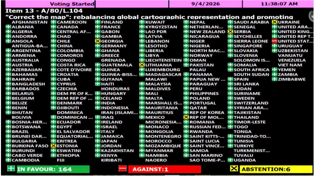
The resolution passed 164-1, with only the US voting against it, calling the move part of a “radical ideology.”
The United Nations General Assembly has adopted an African-led proposal for a new world map, the Equal Earth projection, which shows countries’ true sizes relative to one another, correcting a 450-year-old distortion that has visually shrunk Africa.
The “Correct the Map” resolution, introduced by Togo on behalf of the African Group of 54 member states and co-sponsored by the Bahamas, was passed on Friday by a vote of 164 in favour, one against, and six abstentions.
The United States was the sole country to vote against the resolution.
Why the current map distorts Africa’s size
Most of the world’s maps in use today are based on the Mercator projection, created by Flemish cartographer Gerardus Mercator in 1569 to aid maritime navigation.
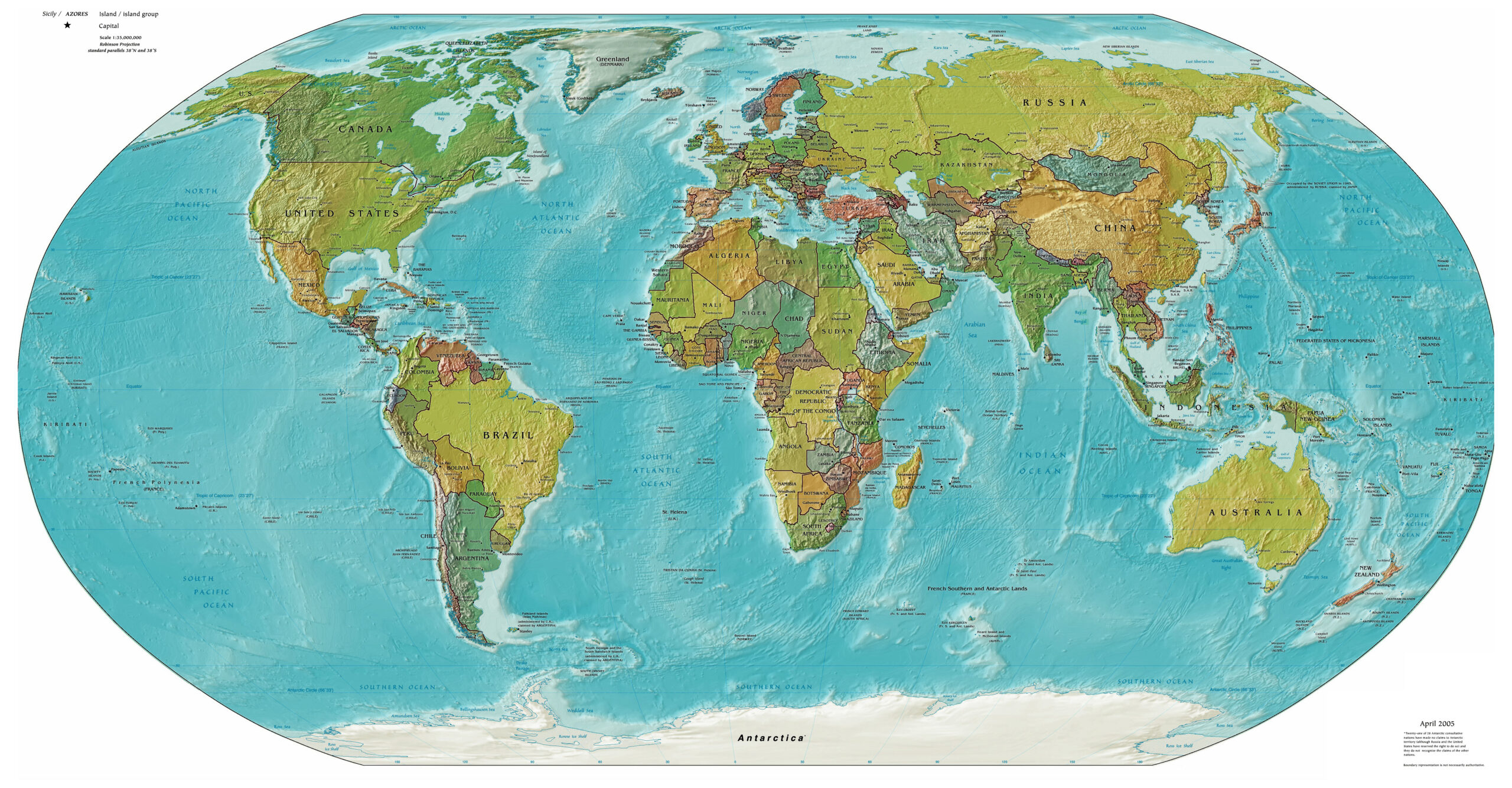
While the projection preserves the shapes of landmasses and allows sailors to plot straight-line courses with a constant compass bearing, it dramatically distorts their relative size, enlarging regions near the poles, such as North America, Europe and Greenland, while shrinking those closer to the equator, including Africa and South America. As a result, Greenland appears roughly the same size as Africa on Mercator maps, even though Africa is about 14 times larger.
The resolution stated that this distortion has contributed to “minimizing the perceived sizes of Africa, Latin America and South Asia, and perpetuating an unbalanced view of the world,” and that it can also minimise perceptions of “socioeconomic realities, infrastructure needs, development potential and prosperity in the Southern regions,” while fuelling prejudices in environmental, geopolitical and security contexts.
What the resolution changes
Speaking before the vote, Togo’s Foreign Minister Robert Dussey said maps carry influence well beyond geography.
“Maps shape our understanding of the world. They guide education, nourish the imagination, and influence collective perceptions,” he said, adding that adopting the new map was not intended as an attack on Europe or any other civilisation, but a reflection of Africa “taking responsibility to change what we can change ourselves.”
The Equal Earth projection, developed in 2018 by cartographers Tom Patterson, Bernhard Jenny and Bojan Šavrič, follows the Earth’s curvature to depict continents in their true relative proportions.
The African Union formally adopted the Equal Earth map in March, before Togo submitted the request to UN member states in April on the AU’s behalf, leading to informal consultations in July and Friday’s vote.
The resolution is non-binding and does not ban the Mercator projection outright, but encourages governments, international organisations and educational institutions to adopt the Equal Earth map instead. Advocacy group Africa No Filter, one of the campaign’s lead organisers alongside Speak Up Africa, welcomed the outcome.
“We want to see accurate maps in schools, textbooks, newsrooms, businesses and on the digital platforms billions of people use every day,” the group said. French Foreign Minister Jean-Noël Barrot also welcomed the vote, writing on X, “Changing the map obviously doesn’t change the world. But correcting a representation that distorts it is already an act of truth.”
The US delegation opposed the resolution, describing it as part of “the much larger and more radical ideology” rather than an innocuous cartographic update.
“This resolution mocks the work and purpose of this institution,” the American representative said.
The six countries that abstained were not officially detailed in UN records reviewed for this report.
For now, the change is largely symbolic rather than immediate. Textbooks, atlases, GPS systems and classroom posters worldwide still overwhelmingly use Mercator-based maps, and any large-scale shift toward Equal Earth will depend on individual governments, publishers and tech companies choosing to act on the UN’s non-binding recommendation.