
The 2026 Annual Flood Outlook identifies 30,707 communities across Nigeria as facing varying levels of flood risk. From peak flood periods to threatened farmland, vulnerable infrastructure and the importance of early warning, here’s what the report says and why it matters.
Nigeria could experience another severe flood season in 2026, with the Annual Flood Outlook (AFO) identifying 30,707 communities across the country as facing varying levels of flood risk. Produced by the Nigeria Hydrological Services Agency (NiHSA), the report outlines where flooding is most likely to occur, when it is expected to peak, and the measures needed to reduce its impact.
Here’s what you need to understand about this year’s flood threat, from seasonal patterns to vulnerable infrastructure to what action means.
10 key takeaways from the report:
1. 30,707 Communities At Risk

Nearly 31,000 communities face flooding in 2026. During the peak July–September period alone, 14,158 communities face high risk, 15,621 face moderate risk, and 923 face low risk, spread across 34 states. This is not a regional problem. It is a national emergency affecting every geopolitical zone.
2. The Peak Period is July Through September
The most dangerous three months for flooding are July, August and September 2026, the JAS season, when the Niger and Benue rivers reach their highest levels.
A second, often underestimated danger window follows in October and November, when dam releases and late-season rainfall can trigger “black flood” events, even after the rains have begun to subside. Communities should prepare now for what will happen then.
3. Over 4Million Hectares Of Farmland Are Threatened
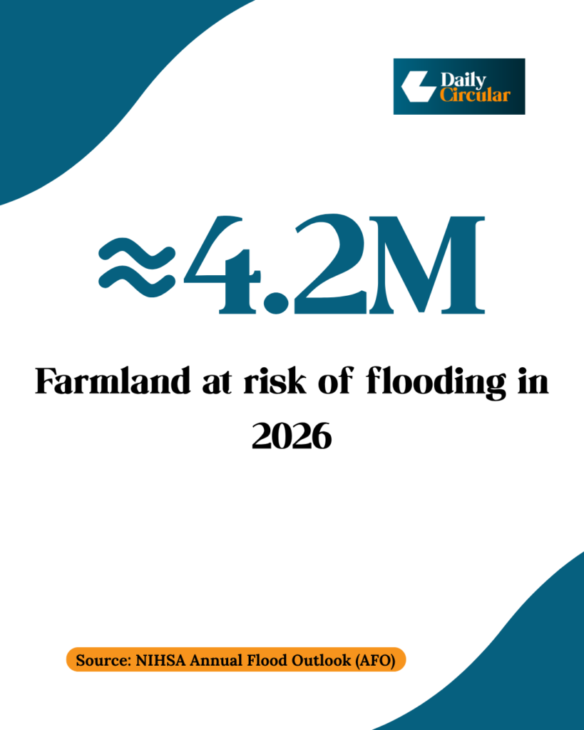
Approximately 4.2 million hectares of agricultural land face flood risk during the year, including 2.8 million hectares during the peak JAS season. This threatens Nigeria’s food security directly. Crop destruction means food scarcity. Livestock deaths reduce protein availability. Farmers lose income and cannot replant next season.
4. Thousands of schools and health facilities are located in flood-prone areas
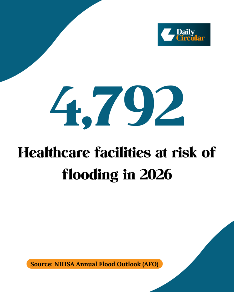
Healthcare facilities and schools sit in flood zones nationwide. When hospitals and clinics flood, they cannot function. When schools flood, children lose months of education. Flooding can interrupt education, reduce access to healthcare and complicate emergency response when communities need essential services most.
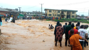
5. Major urban centres are in Danger
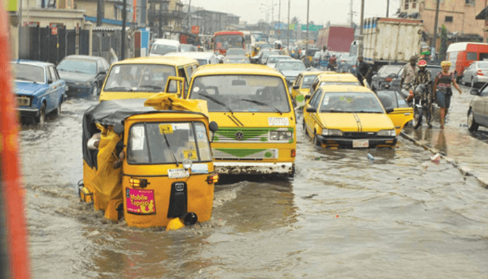
NiHSA’s 2026 outlook ranks ten urban flood hotspots for the year, led by Lagos (urban drainage failure, blocked waterways, coastal surge), Rivers, Kogi, Benue, Oyo, Delta, Edo, Delta/Anambra, Adamawa and Kano. Flooding in major commercial centres can disrupt transportation, businesses, markets, public services and supply chains, with ripple effects across the wider economy.
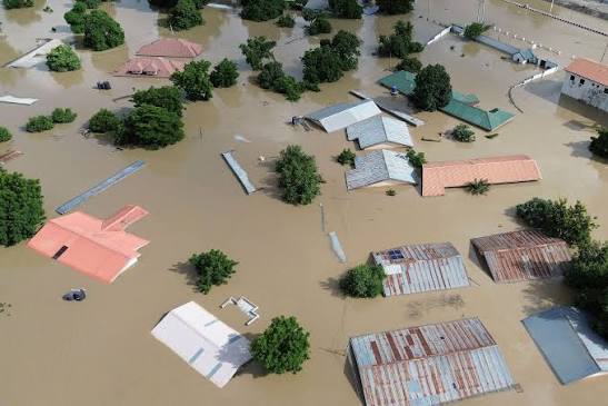
6. Past Floods Killed Thousands And Displaced Millions
According to NEMA’s After Action Review, 2024 was Nigeria’s most devastating recent flood year: over 1,237 people died, more than 5.2 million were affected, and roughly 1.24 million were displaced. Coordinated early warning and anticipatory action helped cut that toll sharply in 2025 — 241 deaths, about 460,000 people affected, and 158,588 displaced. These numbers show both the scale of what is possible in 2026 without adequate preparation, and what effective early warning can achieve when it works.
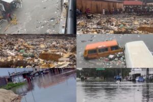
7. Human Activities Are Making It Worse
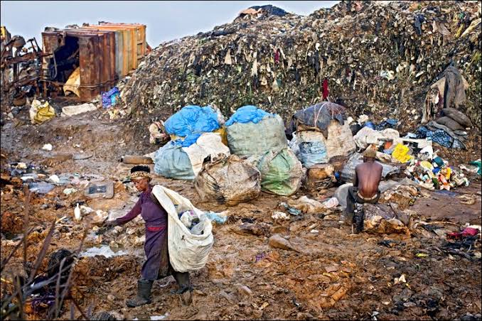
NiHSA identifies poor urban planning, deforestation, blocked drainage channels and unregulated land development as major factors amplifying flood impacts alongside natural drivers like intense rainfall and rising river levels. Buildings constructed on waterways remove escape routes for floodwater. Sand mining destabilises riverbanks. These human actions transform manageable weather events into disasters. : While rainfall cannot be controlled, better environmental management and urban planning can reduce the severity of flooding and the damage it causes.
8. The Forecast Is Based On Comprehensive Data
The 2026 AFO draws on NiHSA’s National Flood Forecasting System (NFFS), which combines conventional hydrological modelling, ground-based monitoring across Nigeria’s eight hydrological areas, and AI-driven predictive tools, supported by data partners including NASA, the European Space Agency, NiMet and GRID3 Nigeria.
NiHSA notes that uncertainties remain, particularly regarding unscheduled dam releases and local drainage conditions.
The outlook is based on scientific analysis designed to support early warning and disaster preparedness rather than historical data alone.
9. Flooding May Be Followed By Drought
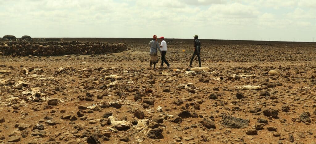
After peak flooding season ends, drought conditions can emerge in parts of the country. This creates a compounding challenge for agriculture and water resources, as flood-damaged farms may also struggle with reduced water availability later in the year.
10. Early Warning Works But Only If Actions Are Taken
The 2025 flood season offers a genuine proof of concept: anticipatory cash transfers to over 75,000 people in Adamawa State, 800,000 Red Cross volunteers mobilised for community early warning, and coordinated NEMA drills in high-risk states all contributed to a 76 percent drop in fatalities compared to 2024.
NiHSA also recommends embedding flood-risk maps into planning decisions, establishing a dedicated flood-risk financing mechanism, and giving the Annual Flood Outlook stronger institutional backing.
The challenge for 2026 will be translating these lessons into nationwide preparedness before peak flooding begins.
What This Means For Nigerians
If you live in a flood-prone area, now is the time to identify evacuation routes and clear drainage channels around your home. Farmers should monitor seasonal forecasts and prepare for possible disruptions, while schools, hospitals and businesses in vulnerable communities should review their emergency response plans.
Residents can also engage state and local governments on how flood-risk maps are being used to guide development and disaster preparedness. The 2026 Annual Flood Outlook offers one of the clearest assessments yet of Nigeria’s flood risk. Whether those warnings translate into fewer lives lost and less damage will depend largely on how governments, communities and individuals prepare before the waters rise.
By the Numbers
- 30,707 communities at risk nationwide
- 14,158 high-risk communities during July–September
- 15,621 moderate-risk communities
- 923 low-risk communities
- 4.2 million hectares of farmland threatened
- 10,684 schools in flood-prone areas
- 4,792 health facilities at risk
- July–September peak flood season
- More than 1,200 deaths recorded during the 2024 floods
- 241 deaths recorded during the 2025 flood season following enhanced preparedness
Source: Nigeria Hydrological Services Agency (NiHSA), 2026 Annual Flood Outlook, and National Emergency Management Agency (NEMA), 2026 After Action Review (AAR 2025).